
Higger Tor - Peak District Walk
Tuesday 25th September 2018
As the weathermen predicted today was going to be rather sunny I was keen to get out for a walk. A late start and the need for a shorter walk meant that I opted for a favourite route around Higger Tor which I last did in May 2016.
Start: Upper Burbage Bridge (SK 2601 8298)
Route: Upper Burbage Bridge - Burbage Rocks - Carl Wark - Higger Tor - Fiddler's Elbow - Upper Burbage Bridge
Distance: 3.75 miles Ascent: 237 metres Time Taken: 3 hrs
Terrain: Clear paths with some scrambling.
Weather: Dry and sunny with a strong breeze.
Pub Visited: None Ale Drunk: None

It was early afternoon when I arrived at the car park and the school parties were already back on the rocks perfecting their rock climbing skills.

Unfortunately the late arrival also meant the sun was nice and high and facing the exact direction I would be walking in.

The only thing for it is to take lots of photos looking backwards. Here looking back along the path towards the car park and Cowper Stones.

One day I might walk along the path below Burbage Rocks, but for now I'll stick to the higher path and enjoy the views down the valley.

As my knee was playing up I was under instructions to take it slow and take lots of photos. Here again looking back along Burbage Rocks, but with Stanage Edge now in view.

Across the valley Higger Tor and Carl Wark get closer, with Eyam Moor now visible beyond them.

I wonder how long it will take for the areas of the valley where the trees were removed to recover.

As the descent off the edge begins the view back along the valley improves, with Fiddler's Elbow and Stanage Edge now in view.

After all of last week's rain I'm amazed at how dry the ground still is. This section of path usually involves a bit of bog-hopping.

It is so dry I abandon plans of lunch sat on some rocks ahead and instead find a spot close to the path and enjoy the views back along the edge.

Combined with a view across the valley to Higger Tor.

Carl Wark completes the lunchtime view.

I had stopped just before I reached the path down into the valley so shortly after lunch I found myself looking back up at the edge I had just been sat on. The one thing that is very noticeable on this side of the valley is how the bracken is starting to die back, always a good thing and a sure sign of Autumn approaching.

Rather than take the newly engineered path down to the bottom of the valley I stick to the original footpath which will take me down to the same point.
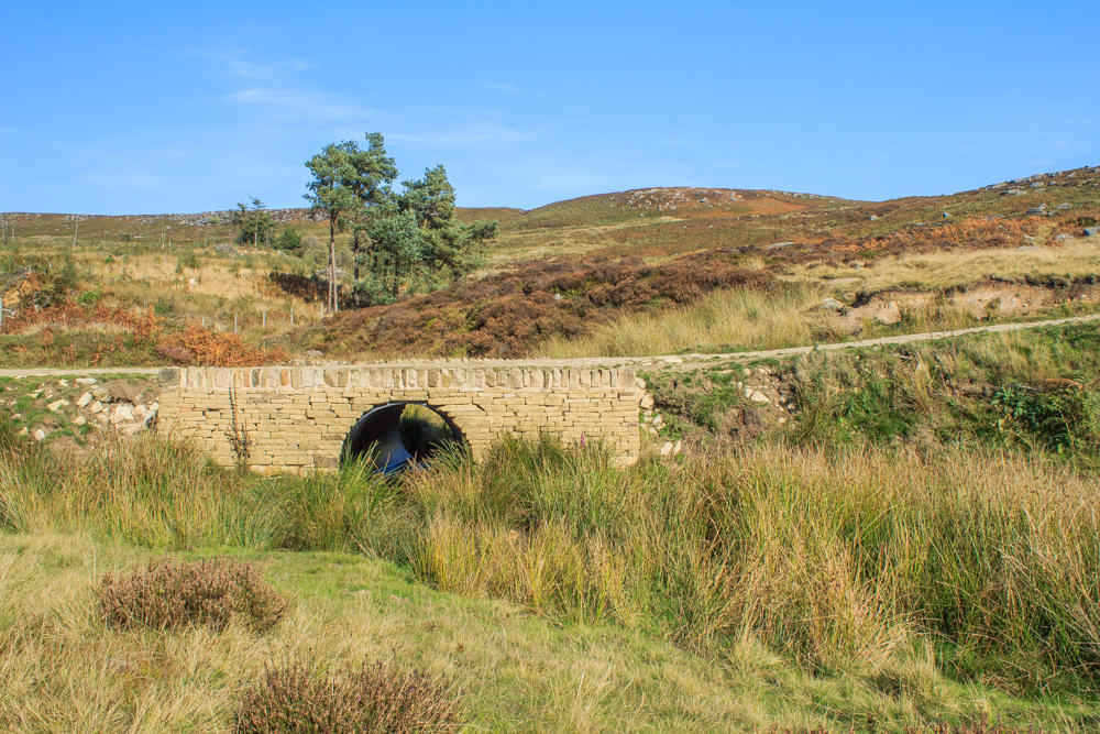
I emerge onto the engineered path just above this bridge, which appears to be new. I certainly don't recall seeing before.

I do however remember seeing this bridge before.

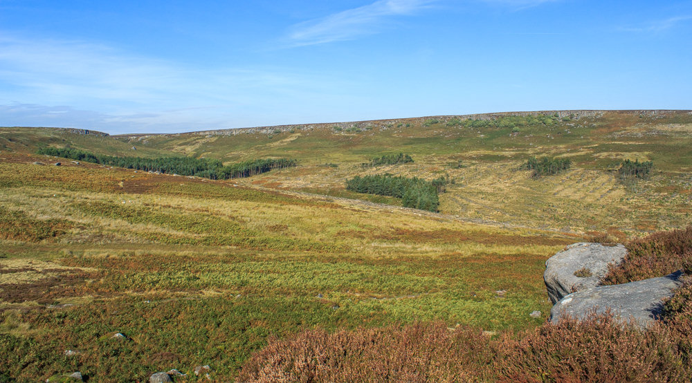
Heading up the path below Carl Wark and now that so many trees have been removed the view along the valley is much nicer.

This is another suprisingly dry section of path, although I still have to negotiate my way around one small section of boggy ground, but I still emerge at the top with dry, mud free boots.

I opt for the diversion up to Carl Wark and enjoy this view down the valley to Longshaw Lodge

Higger Tor from Carl Wark.

I spend a bit of time exploring the area inside Carl Wark.
Burbage Rocks from Carl Wark.

Time to decide which way I'm going up Higger Tor, up the front, with the bit of scrambling or walk along the moor and take one of the easier paths up.

I opt for the scramble and veer left, rather than right, when the steps end to emerge on the top with this view of Carl Wark.

Rather than head along the path towards Fiddler's Elbow I head out along the edge of Higger Tor looking for a rock formation I have heard about.

It turns out I had walked around them when I scrambled onto the top of Higger Tor. At least I now know where they are.

Curiosity satisfied I take the path towards Fiddler's Elbow.

Before I drop off the top I make another short diversion to enjoy the view across Callow Bank towards Win Hill and the Great Ridge.

Looking across to Fiddler's Elbow before dropping off the top of Higger Tor.

The view back to Higger Tor from the path to Fiddler's Elbow.

A final look down the valley before I return to the car.
All pictures copyright © Peak Walker 2006-2023